First published: Summer 2016
In Athosland, Michael Golz takes the viewer on a journey through his lifetime’s work. As a cartographer, inventor and storyteller, Golz has built his own fantasy world with its own culture, history and geography. What started in the 1960s as a childlike game of inventing fictional worlds and creatures with his brother Wulf has developed into an infinite artwork. Today, Athosland manifests itself in three main parts: a giant map; hundreds of scenes and drawings of places, towns, and landscapes; and eight folders full of travelogues about the imaginary country.

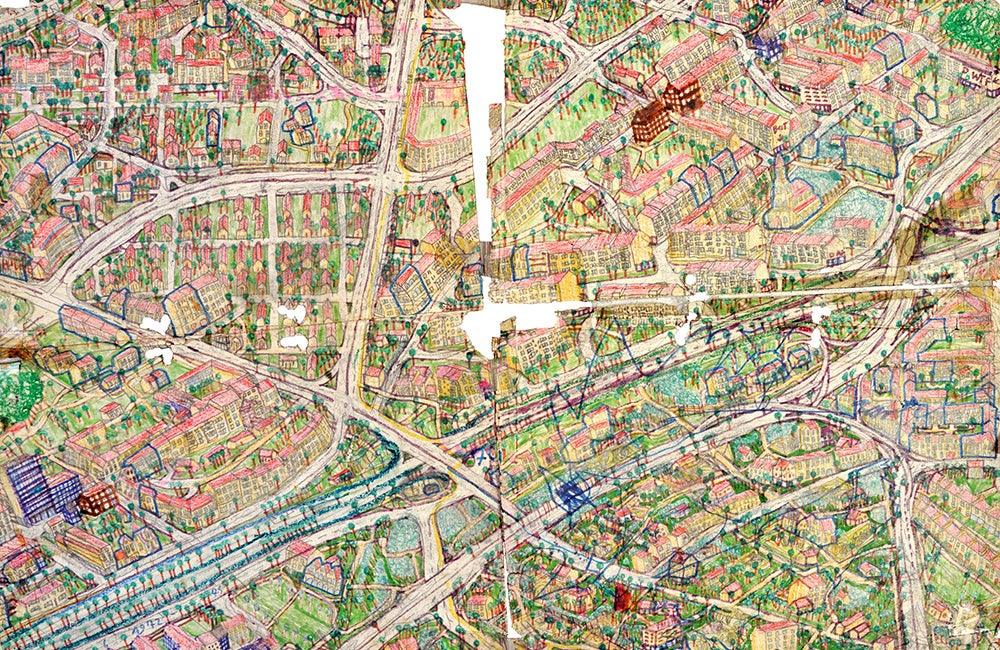
Map of Athosland, detail of Honne Mid-West, Michael Golz, 1977–today, mixed media on paper, 42.9 x 94.5 ins. / 109 x 240 cm, courtesy of Galerie ART CRU Berlin
The most extravagant element in Golz’s Gesamtkunstwerk (total art work) is a giant map. This large-scale pictorial sculpture defines Athosland cartographically. Golz has been working on this current version of the map since 1977. Over the past four decades, around 160 irregularly-shaped pieces have been created, with an average size of 31.4 x 39.4 ins. / 80 x 100 cm. They can be assembled, like pieces of a jigsaw puzzle, into a giant map that is 55.8 x 46 feet / 17 x 14 metres in size.
Athosland is divided into five main regions. In the south is the giant capital, “Athos”. The urban area of this metropolis spreads through the “East Marshlands” on one side and the “Western Region” on the other. In the east is the “Eastern Region”, which merges, in the north-east, into the sparse “Juniper-Desert”, and in the north into the fertile, sap-green “Kindermann Area”. West of Athos-City you can find the rural landscapes of the “Western Region”, as well as the “Land of Castles” and the “Karst Mountains”, which are characterised by the many rivers flowing through them and by their yellow-brown mountains.
This is an article extract; read the full article in Raw Vision #90
